Road & rail corridors
Continuous 3D context for design, mapping and asset extraction.

Dense corridor-scale LiDAR and imagery captured from moving vehicle or vessel platforms for roads, railways, riverbanks and complex urban or infrastructure environments.
MapSoft uses mobile mapping to capture continuous, high-density 3D information along roads, railways, streets, riverbanks and other corridors where vertical structures and roadside detail are important. Vehicle- or vessel-mounted LiDAR complements airborne and terrestrial survey by observing the environment from close range while moving through the corridor.
The workflow integrates LiDAR, imaging, GNSS/INS trajectory processing, control and alignment so that long linear environments can be transformed into measurable point clouds and engineering datasets with consistent geometry.
Continuous 3D context for design, mapping and asset extraction.
Facades, roadside objects, street geometry and public-space detail.
Vessel-based capture connecting above-water structures with bathymetry.
Dense point clouds for engineering mapping and 3D interpretation.
Routes, coverage, speed, control and required outputs.
Platform installation, sensor checks and calibration status.
LiDAR, imagery and GNSS/IMU data captured continuously in motion.
Post-processing, boresight / alignment control and spatial checks.
Georeferenced 3D data prepared for mapping, modelling and integration.
The same mobile mapping principle can be deployed along road and urban corridors or on vessels where the survey must follow a riverbank. Platform choice is part of the project design and depends on the geometry that must be observed.
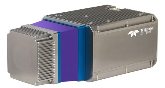
MapSoft's primary mobile laser-scanning sensor supports dense 360-degree corridor capture. It operates as part of an integrated positioning and imaging system rather than as a stand-alone scanner.
Continuous corridor 3D data
Visual support for interpretation
Road, rail and urban mapping
Structures and vertical geometry
Airborne + mobile + bathymetry
Mobile mapping quality is governed by the complete sensor geometry and positioning solution.
 Geospatial
Large-scale multisensor river mapping integrating airborne LiDAR, vessel-based mobile mapping, UAV mapping and multibeam bathymetry into a seamless engineering-ready geospatial foundation for navigation, hydraulic and morphological analysis.
661 kmRiver channels surveyed
View project → Geospatial
A high-resolution urban 3D survey combining UAV and mobile LiDAR, GNSS control, point-cloud processing and CityGML LoD2 modelling to create a validated spatial foundation for circular-construction and building-stock research.
38 missionsUAV flight missions
View project → Geospatial
Specialist geodetic and geospatial work supporting railway modernization through a unified reference framework, an engineering survey network, airborne LiDAR and aerial imaging, field and tunnel survey, 1:1,000 engineering products and confirmed land-expropriation design packages.
235 kmRailway corridor length
View project → Geospatial
Two connected railway geodetic work packages combining engineering control networks, airborne and mobile LiDAR, photogrammetry, tunnel/river field completion and design-ready terrain, orthophoto and topographic products.
148.9 kmConnected railway corridor
View project →