Navigation & waterways
Channel geometry, bottlenecks and safe-navigation analysis.

Multibeam bathymetry and integrated positioning for detailed mapping of riverbeds, waterways and submerged terrain.
MapSoft performs multibeam hydrographic surveying for rivers and inland waterways where reliable submerged terrain is required for hydraulic modelling, navigation, engineering design or morphology analysis. Dense swath measurements provide a continuous 3D representation of the riverbed rather than isolated profiles.
Survey design combines vessel operations, positioning, motion compensation, water-level reference, coverage control and processing. Where a project spans both land and water, bathymetry can be integrated with airborne, mobile, UAV and terrestrial data into one continuous terrain model.
Channel geometry, bottlenecks and safe-navigation analysis.
Dense bathymetric surfaces for flow and morphology models.
Design support for interventions, structures and dredging-related analysis.
Connecting riverbed, banks, floodplain and infrastructure.
Channel geometry, coverage, standards, datum and required deliverables.
Vessel setup, positioning, motion and water-level reference.
Dense swath bathymetry across the riverbed or waterway.
Navigation/attitude integration, cleaning, overlap and consistency checks.
Bathymetric point cloud / DTM integrated with above-water datasets.
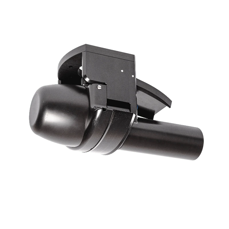
MapSoft uses the NORBIT iWBMS as the primary multibeam bathymetric sensor. It provides dense swath measurements of the submerged surface and is integrated with positioning and motion information for controlled riverbed mapping.
Hydrographic platforms are configured for stable sensor mounting, navigation and field operation. Vessel selection depends on waterway access, depth, manoeuvrability and the geometry of the assignment.
Dense underwater 3D data
Continuous submerged surface
Engineering and hydraulic inputs
Analysis-ready terrain information
Riverbed + bank + floodplain integration
Hydrographic QC is designed around complete seafloor/riverbed coverage and a reliable spatial reference.
 Geospatial
Large-scale multisensor river mapping integrating airborne LiDAR, vessel-based mobile mapping, UAV mapping and multibeam bathymetry into a seamless engineering-ready geospatial foundation for navigation, hydraulic and morphological analysis.
661 kmRiver channels surveyed
View project → Geospatial
A two-phase engineering geospatial survey combining basin-scale airborne LiDAR/photogrammetry and hydraulic field measurements with a later high-detail UAV LiDAR and topographic follow-up in the Bogoštica sub-basin.
1,882 haPhase 1 survey footprint
View project → Geospatial
Specialist geodetic and geospatial work supporting railway modernization through a unified reference framework, an engineering survey network, airborne LiDAR and aerial imaging, field and tunnel survey, 1:1,000 engineering products and confirmed land-expropriation design packages.
235 kmRailway corridor length
View project →