")
")

Infrastructure design
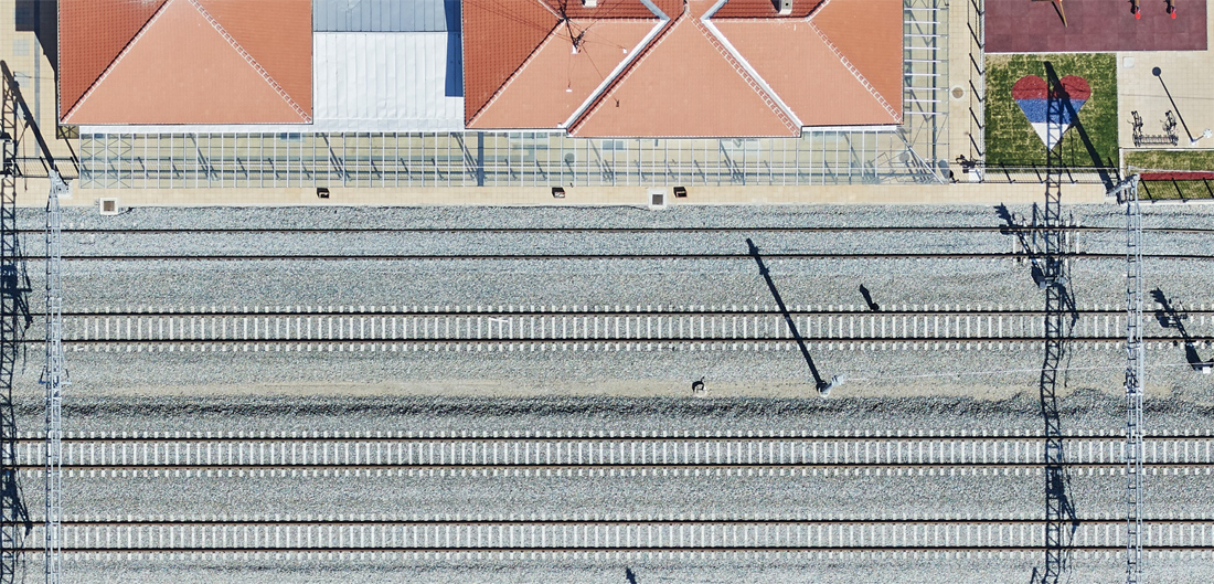
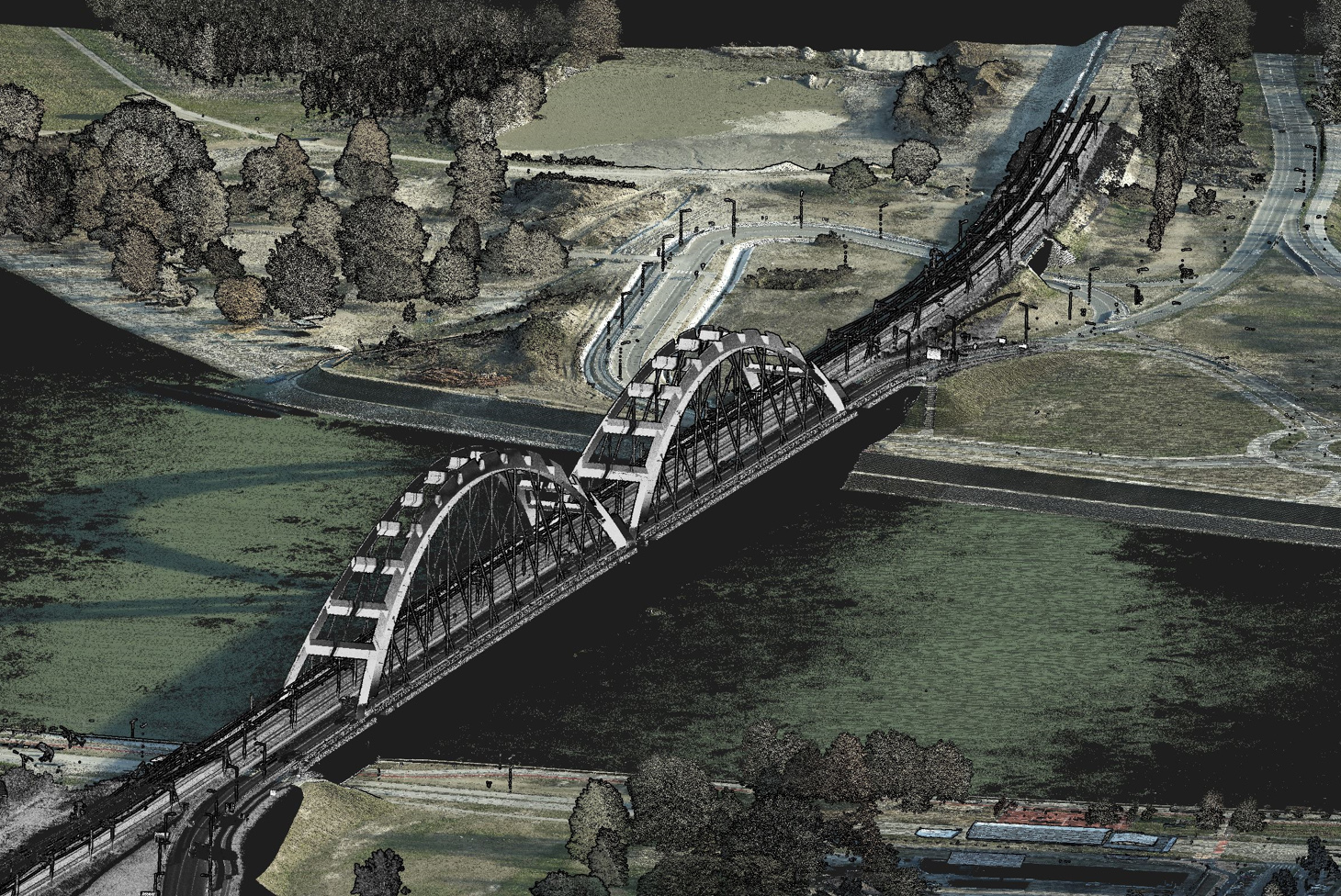
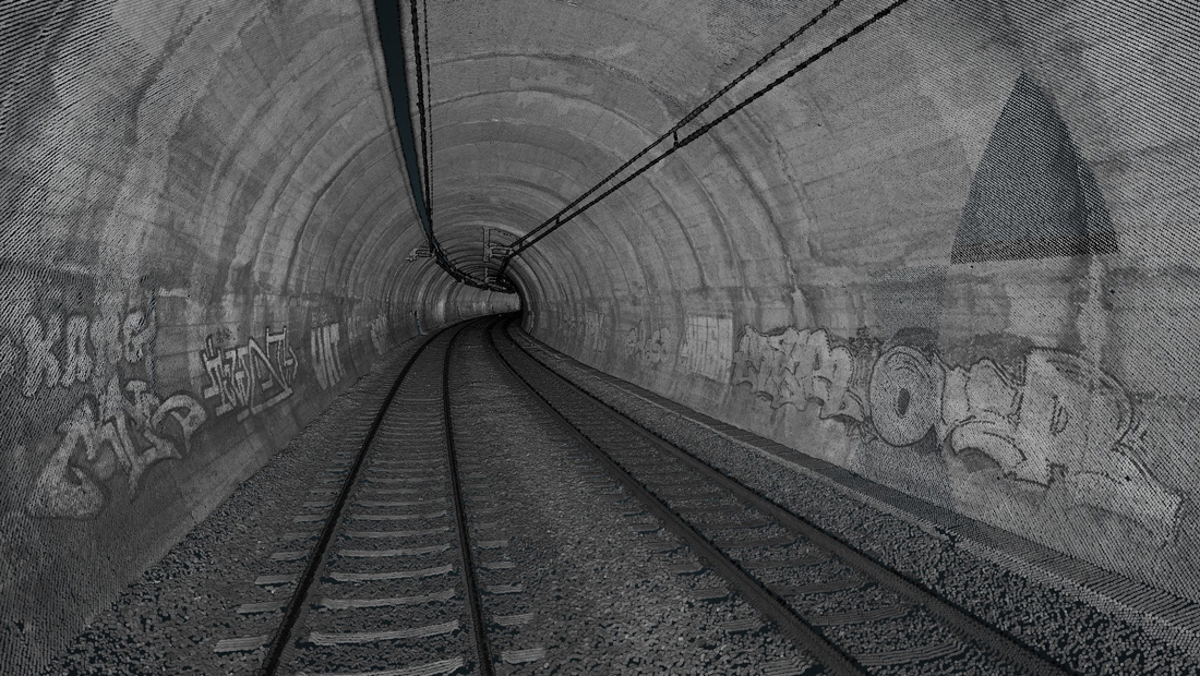
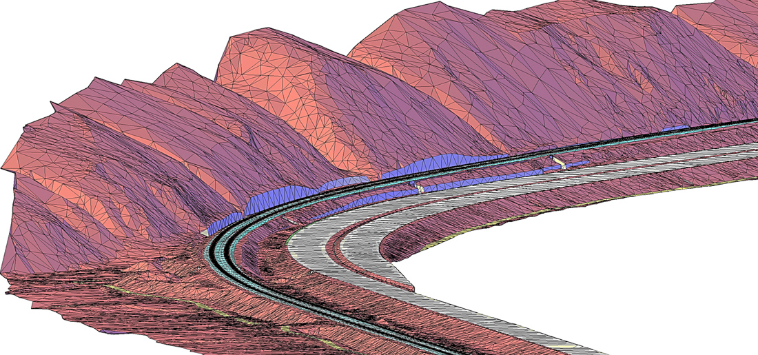
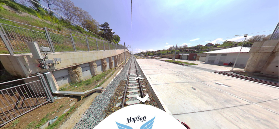
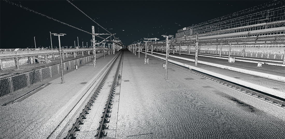
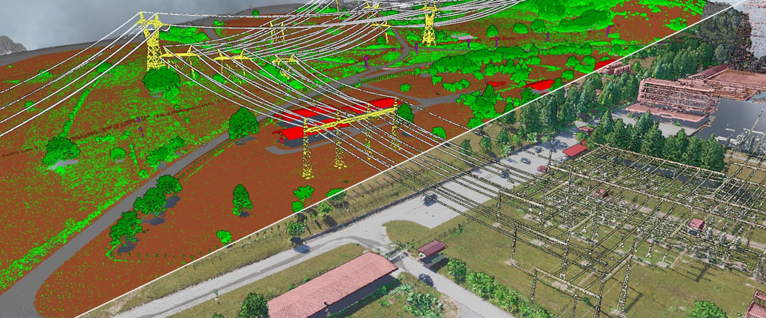
Thanks to the high resolution and accuracy, aerial imaging and LiDAR scanning (ALS) can be used in the production of high-quality topographic products. Simultaneous ALS is ideal for continuous mapping of long corridors for highways, railways, transmission lines, pipelines and other large infrastructure projects. Additionally, the mobile laser scanning (MLS) and georeferenced spherical images collection technologies, which we also apply, allow to complement the data obtained by ALS so that spatial data can be successfully collected for all parts of infrastructure facilities (tunnels, for example). By using the mentioned technologies, digital terrain models (DTM) and point cloud are obtained, which cannot be achieved by traditional surveying techniques or photogrammetry. This especially applies to rural, inaccessible terrain, covered mostly with vegetation, where the probability of a lack of GNSS signal is quite high.
In case of need and at the request of designers, using automated procedures, MapSoft can create topographic products even for larger areas in an extremely short period of time (fast orthophoto and DTM). From our experience, these topographic products are more than of sufficient quality that designers can start the design process within just a few days after the completion of the survey.
Considering the time required for data collection and processing, costs and timescales for data delivery, there is currently no better technology that provides high-quality topographic data in the short term, at an acceptable price. Therefore, it is not surprising that ALS/MLS technology is increasingly used in the design of new and reconstruction of existing highways and railways. This technology represents a fast, accurate and very cost-effective solution in this area.
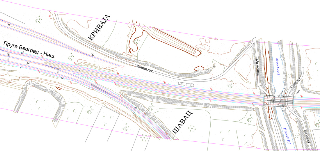
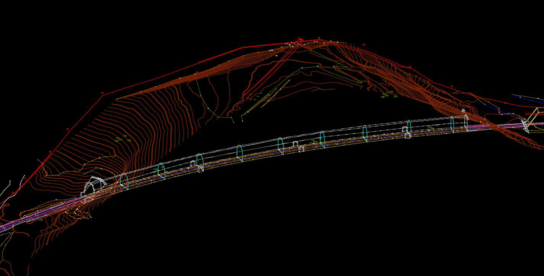
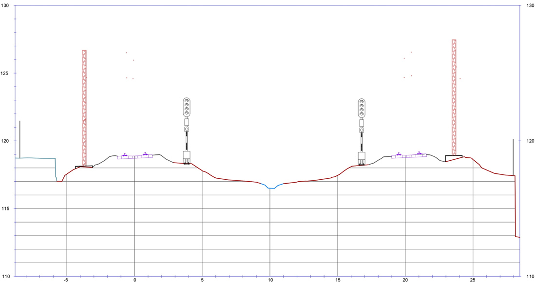
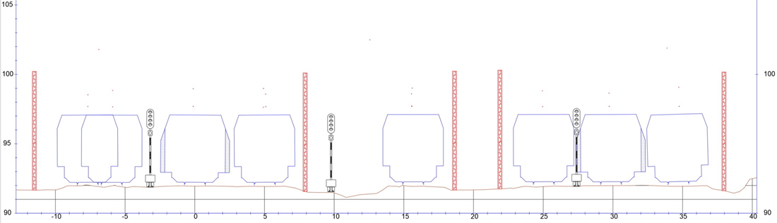
Examples of products for infrastructure projects
Click to enlarge
Benefits
- Contactless acquisition of precise data about roads, railways and their surronding areas
- The fastest way of data collection for design and changes detection
- Simple creation of longitudinal and cross sections
- Analysis of sight for the needs of stopping and overtaking
- Calculation of heights under the bridges and power lines crossing the roads and railways
- Detection of object that endanger roads and railways
- Detection of traffic signs, lights, bus stations, sound walls,…
Projects
- Acceptance test on railway Novi Sad - Subotica
- Solar powerplant at the parts of Nikšić and Cetinje municipalities
- Reconstruction, electrification and modernisation od railway Vrbas - Sombor
- Reconstruction, electrification and modernisation od railway Pančevo - Subotica
- Solar powerplant Montečevo
- DBP ring road around Belgrade, sector C
- Railway Stalać - Kraljevo
- Railway Kraljevo - Rudnica
- Railway Belgrade-Niš
- Acceptance test on railway Belgrade – Novi Sad
- Reconstruction of railway Ostružnica - Batajnica
- DBP (railway Subotica - Horgoš)
- DBP/DFC (Novi Sad - Ruma corridor)
- Design of lines 1 and 2 of the Belgrade metro
- Reconstruction of railway line Resnik - Velika Plana
- Reconstruction of railway line Velika Plana - Niš
- Connection to highway, Iverak - Lajkovac
- Highway Požega - Kotroman
- Infrastructure objects, Jadar basin
- Highway Belgrade - South Adriatic
- Highway Bubanj potok - Pančevo
- Outer magistral tangent around Belgrade
- Highway E-763, section New Belgrade-Obrenovac
- Highway E-761, section Adrani-Kruševac