")
")

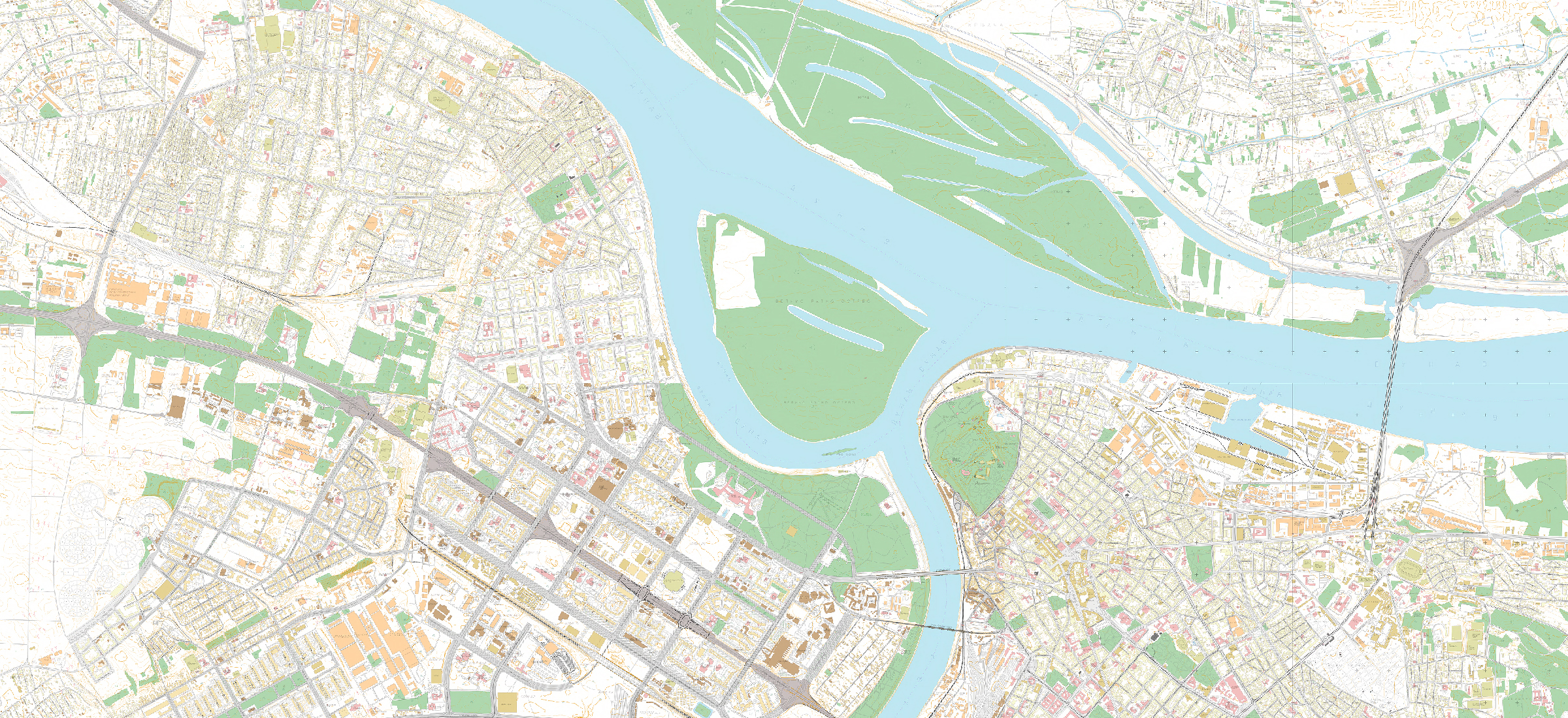
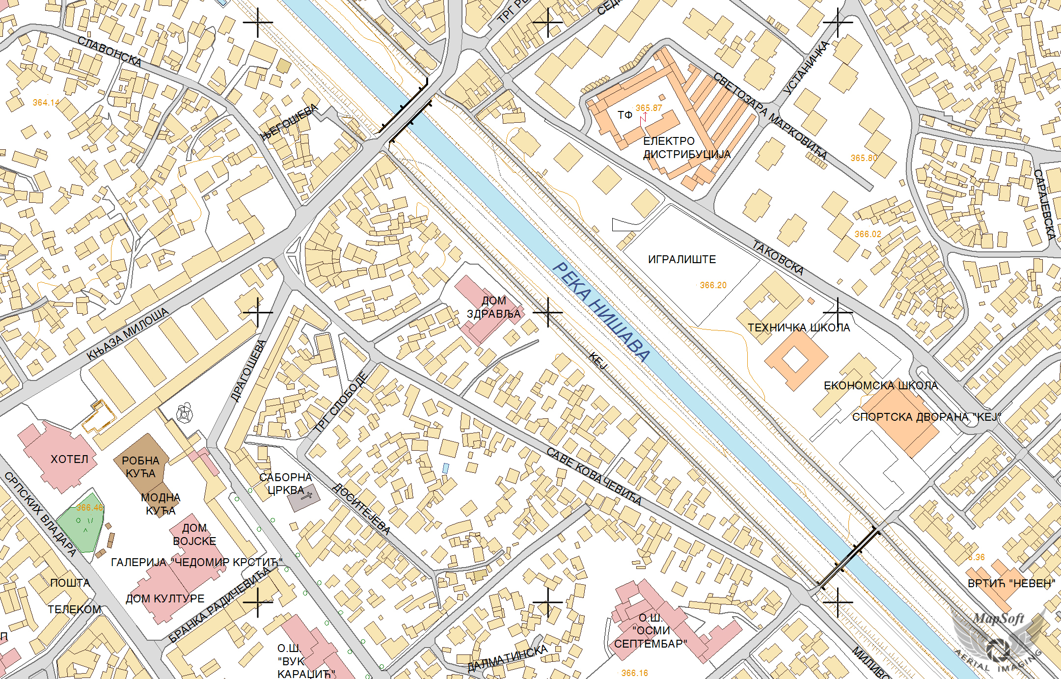
Topographic mapping
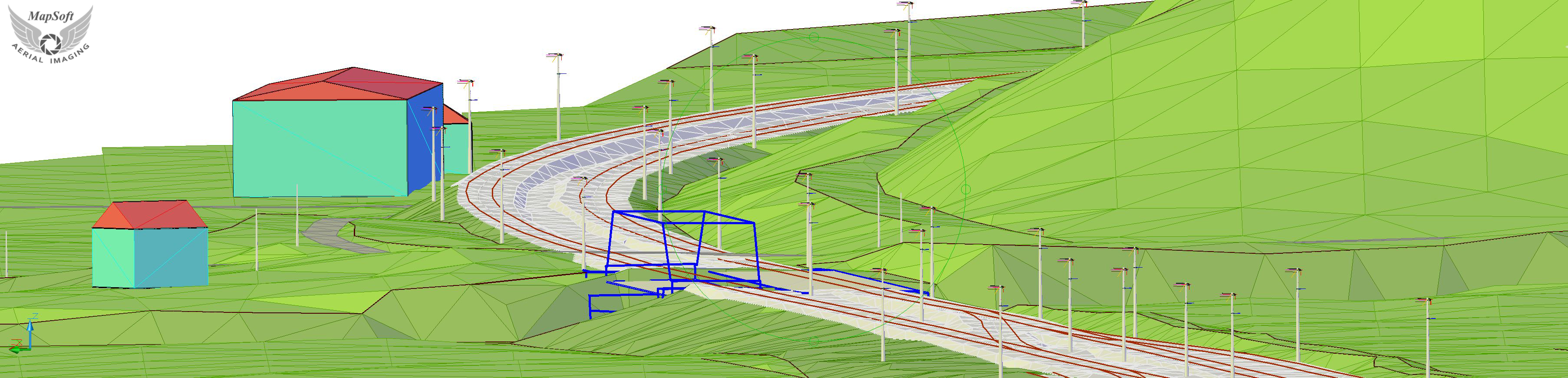
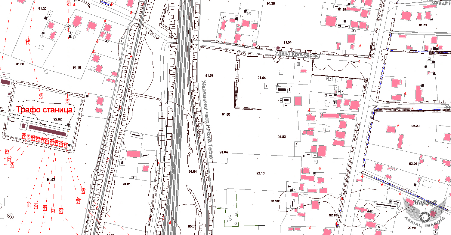
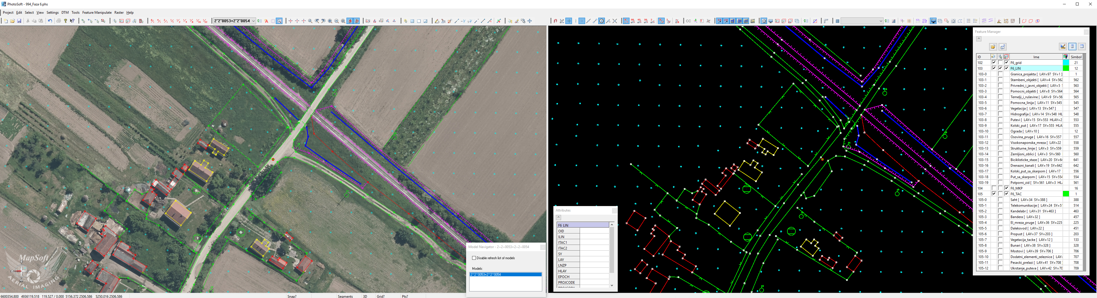
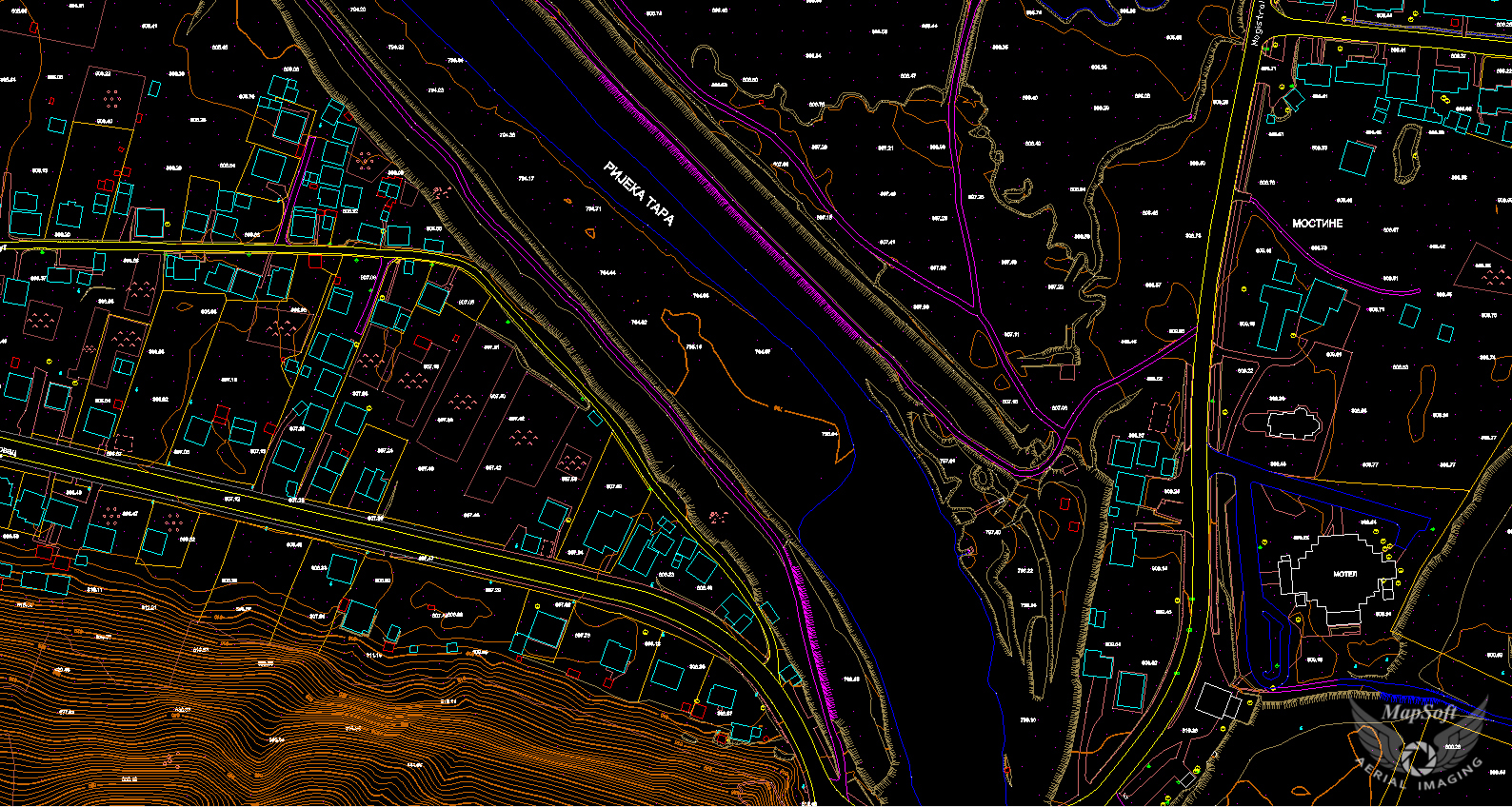
Digital topographic map (DTP) is a standard digital topographical base, which now completely replace the classical / analogue topographic plan in all areas where it is used for designing software for computer aided design (CAD). Spatial data shown at topographic maps are collected at digital photogrammetric workstations (PhotoSoft), processed and exported to the desired CAD (DWG, DXF, DGN, ...) or GIS (SHP, MIF, GML, ...) format in MapSoft's own software system.
Aerial photogrammetric method is the optimal method for the production of digital topographic maps of larger or medium areas. In verification and control process classic field method is very expensive because it implies going out again to the field and repeat the whole process. Every project completed in MapSoft implies a previous analysis of the client needs from which it selects the optimal content, accuracy and format supplied vector data. Approach is to collect only the original data from georeferenced aerial images and LiDAR point cloud, and the subsequent processing of generating various derivatives of the underlying data. Modern software tools, years of experience in this field, working procedures and internal quality control are set to ensure that customers will be supplied with topologically checked vector data in accordance with the required accuracy and content.
Specification
- Map scale from 1:500 to 1:10.000
- 2D, 2.5D or 3D
- Standard CAD or GIS file formats or database
Applications
- Infrastructure design (roads, railways, power lines,…)
- Environmental protection
- Urbanism and spatial planning
- Insurance