")
")


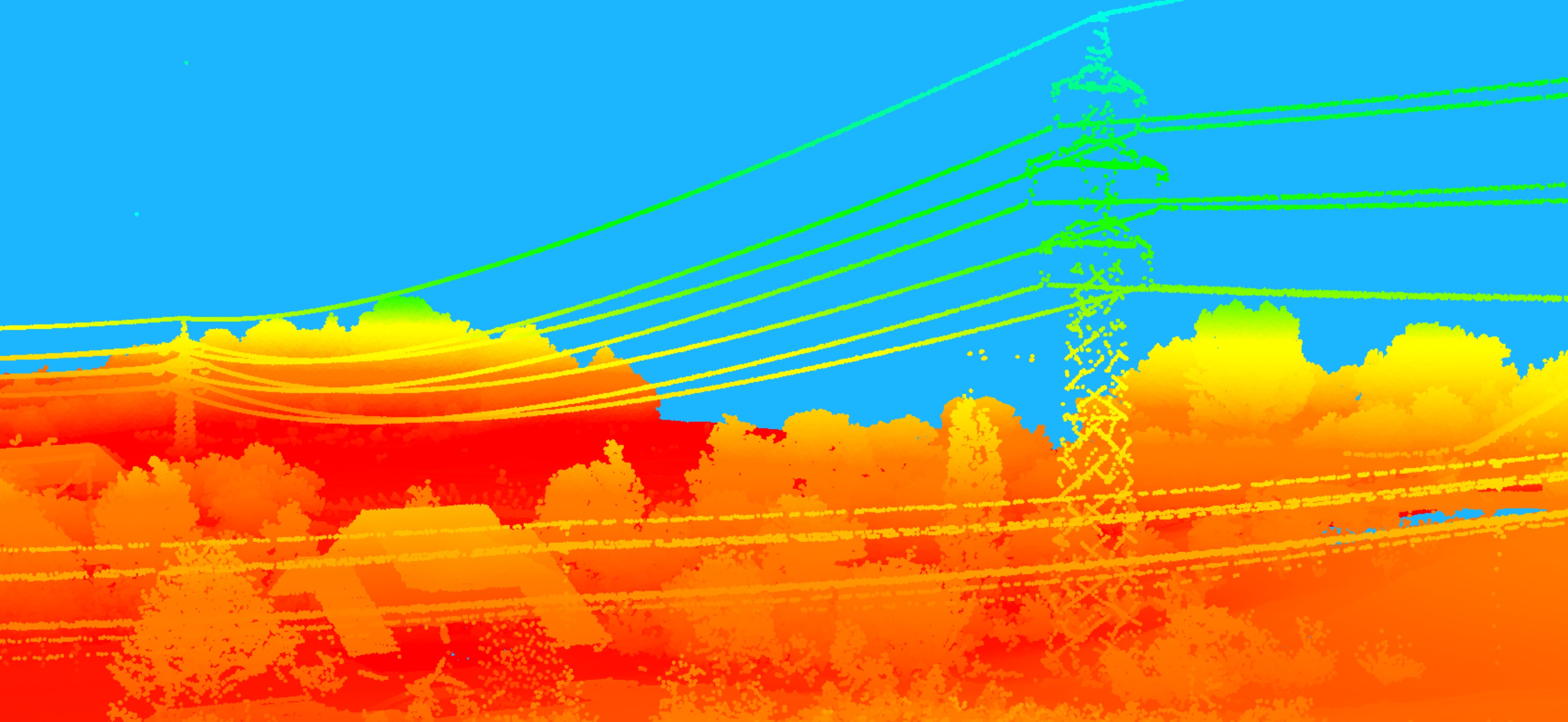

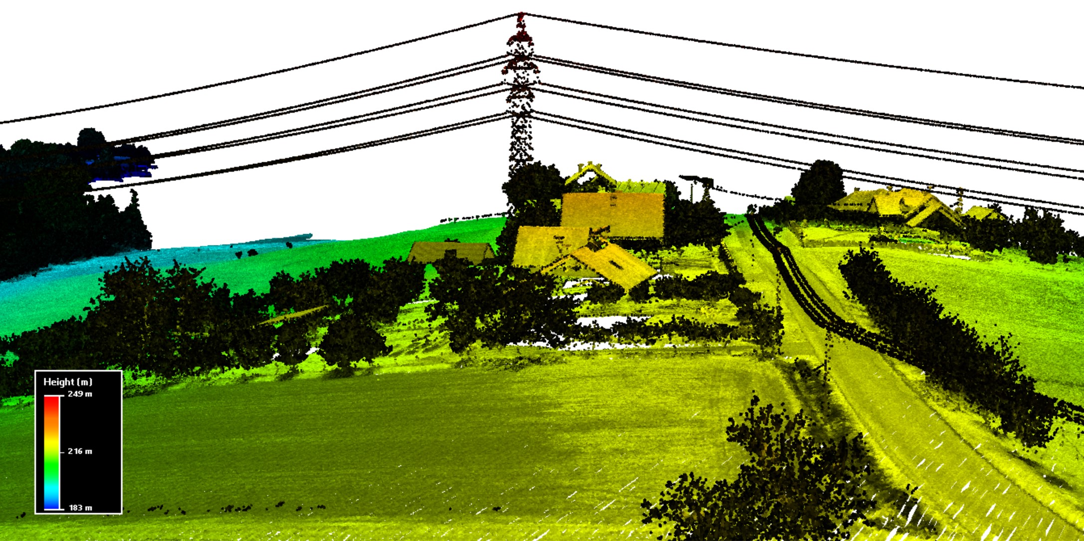
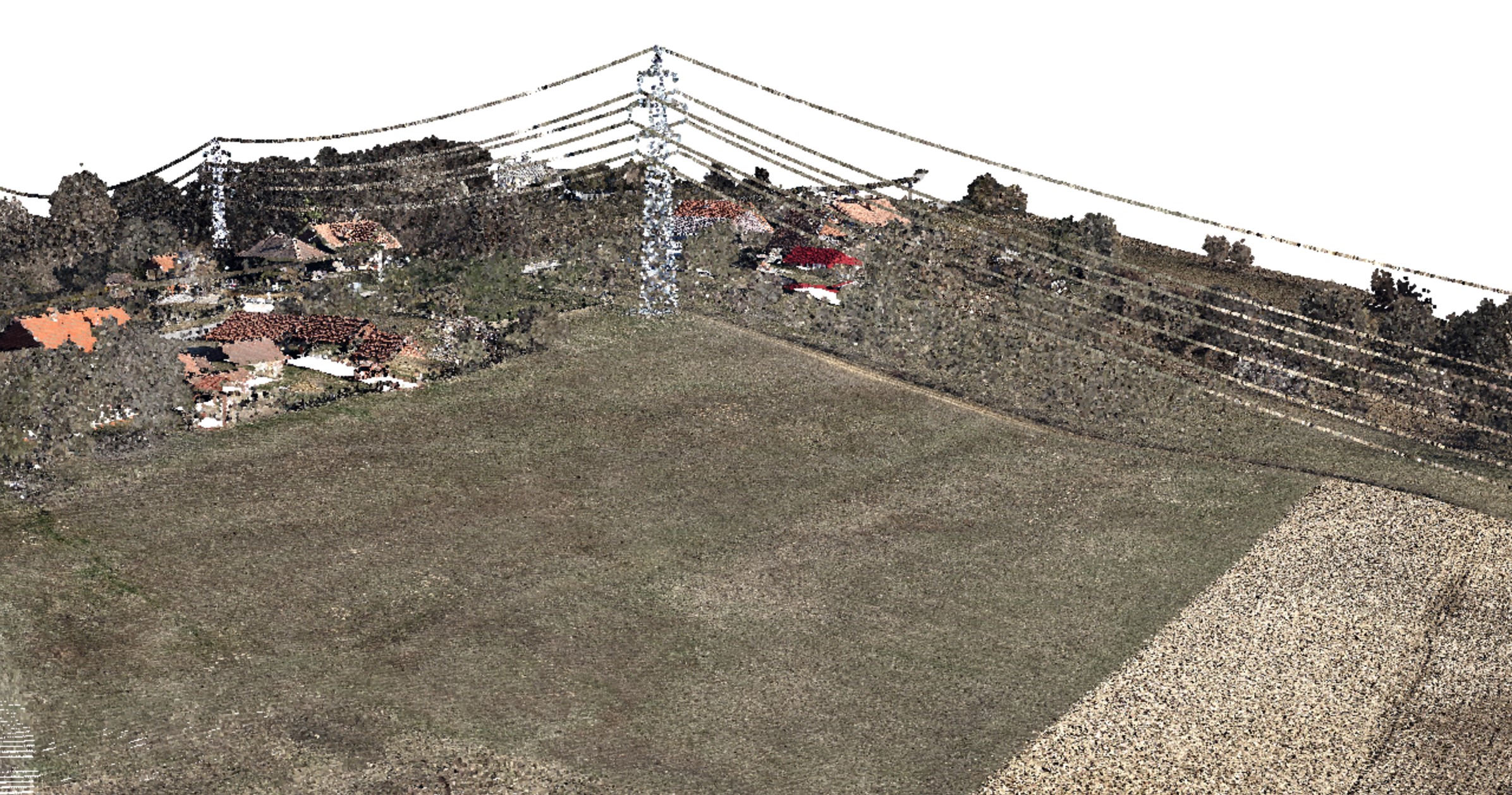
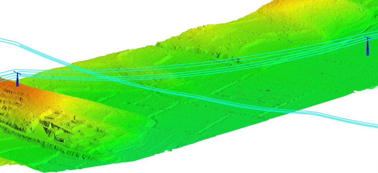
Power line mapping
LiDAR is an effective way of mapping existing powerlines and the surrounding terrain features, vegetation, buildings and other structures. A LiDAR system operating from a low altitude airborne platform has no difficulties accessing and surveying even the roughest terrain quickly, cost-effectively and without putting people at risk.
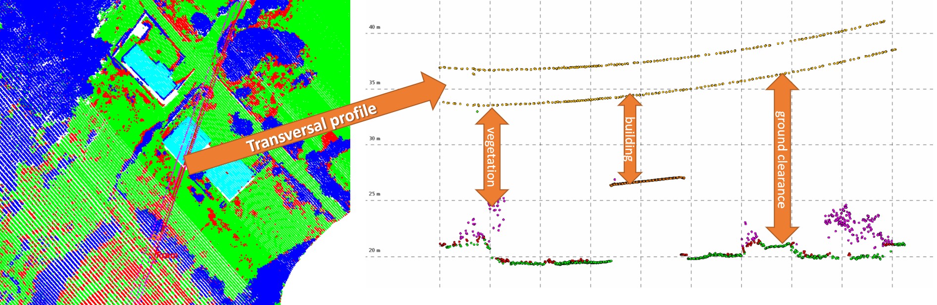
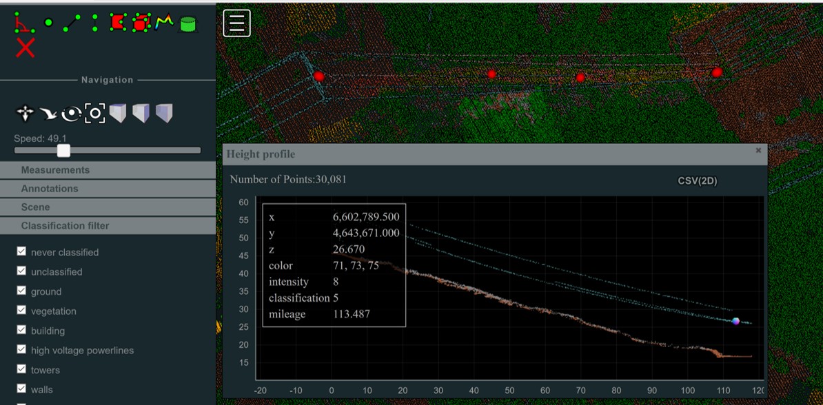
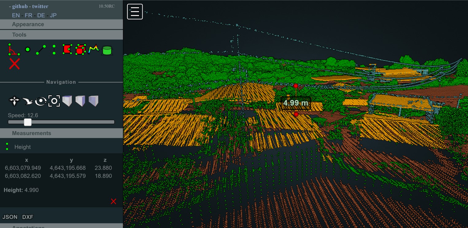
Modelling of the ground is based on classified points, but in addition wires, attachments and towers can be vectorized. Using LiDAR system data, vegetation or other objects close to power line corridor can be easily detected. It is also possible to observe slopes vulnerable to erosion and determine the impact on the power line.
Modelling of the ground is based on classified points, but in addition wires, attachments and towers can be vectorized. Using LiDAR system data, vegetation or other objects close to power line corridor can be easily detected. It is also possible to observe slopes vulnerable to erosion and determine the impact on the power line.
Specification
- Can be delivered as:
- classified point cloud
- 3d vector
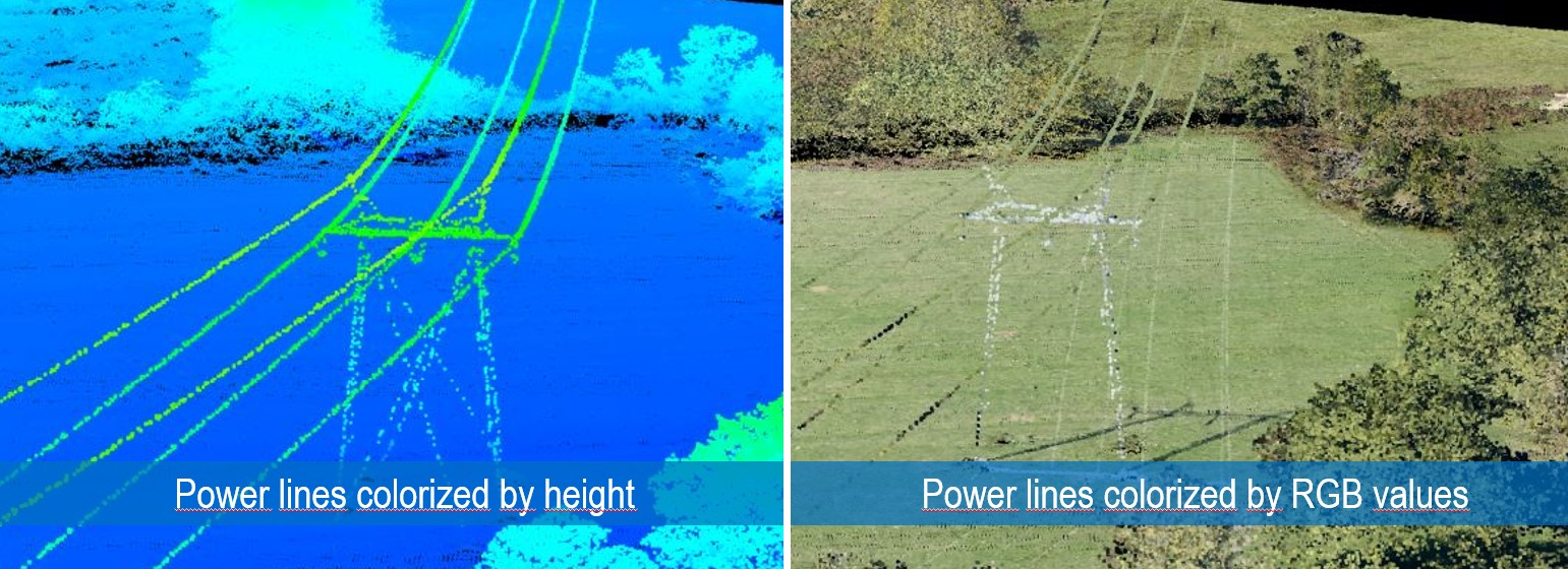
- Precise wire detection, even low voltage street electrical network
- 5-15 cm accuracy
Applications
- Network design
- Asset management
- Risk analysis:
- Automatic detection of risk areas that could endanger lines
- Position of any type of risk areas (tree growth, tree fall, cross powerline, water bodies crossing, …)
- Level of dangerous
- Clearance distances between wires and other features (buildings, ground…)
- Automatic detection of risk areas that could endanger lines