")
")


Solar potential cadaster
The EU's strategic decision to increase the share of electricity production from renewable energy sources over time is visible through clearly defined goals. Thus, in 2009, EU leaders set a goal that by 2020, 20% of energy consumption in the Union comes from renewable sources. Then, in 2018, the goal was set that the share of energy consumption from renewable sources in the Union by 2030 will be 32%. One of the ways to achieve the set goals is to use solar energy from solar panels installed on the roofs of residential and commercial buildings. The cost of operating and maintaining solar panels is low, and the modules can be efficiently installed on the roof, which is useful for cities, where space is limited by resources.
In order to bring the owners of buildings closer to the possibilities of obtaining energy from solar panels installed on roofs, in many countries, regions and cities, projects have been launched to form a cadastre of solar potentials. These projects aimed to calculate the solar potential of the roofs of each building and create a web portal through which the citizens were informed in a simple way.
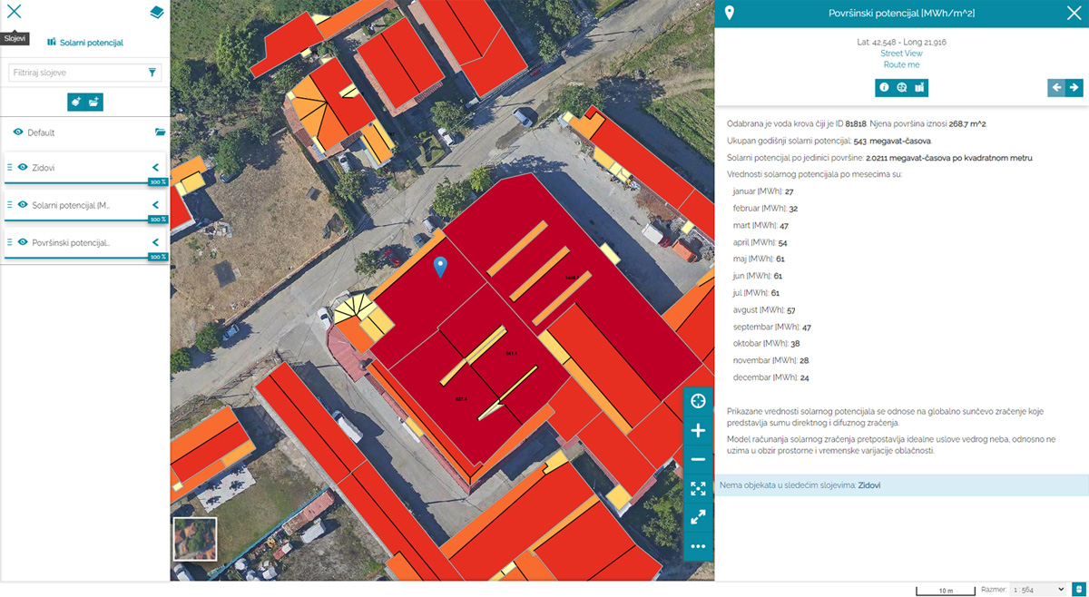
Depending on the position of the Sun, the season, the geometry and the nature of its surface, each roof has its own solar potential, ie. potential for energy production. In addition to having information about the solar potential of the area and individual buildings in it, the potential for energy generation can be predicted using photovoltaic and solar thermal systems. As the position of the Sun is unchanging, and the number of sunny days during the year is a matter of already established statistics, a necessary step in order to calculate the solar potential is to determine the geometry of the roof structures as precisely as possible. The dominant method of determining the geometry of roof structures is the laser scanning method (LiDAR) from the air, which in a short time it is possible to obtain very precise data on the basis of which semi-automatic methods can make 3D models of objects and thus determine the orientation, slope, useful roof area.
Combining capacities in the field of spatial data acquisition and software development, MapSoft offers cities and municipalities a unique solution that through the collection of spatial data by LiDAR method (high-density and accurate laser scanning), calculation of solar potential and display of results on MapSoft Geoportal, allows every owner to see potential for the use of solar energy, on a monthly or annual basis, and draw a conclusion on the suitability of the building for the installation of solar panels.

Specification
- Sophisticated calculation based on 3D building models, digital surface model, digital terrain model, local shadowing (trees, neighboring buildings) and amount of sun irradiation
- 2D, 2.5D or 3D building model + DTM + orthophoto
- Data as GIS database
- Possibility of publishing through web application (MapSoft geoportal)
Applications
- Local authorities
- Power companies
- House owners and citizens