")
")
Land evaluation and classification
Agricultural engineers are involved in land consolidation works, but in two important phases they are leading factors:
- Land evaluation
- Land classification
Land evaluation
Determining the value of land or land evaluation is a prerequisite for fair replacement of agricultural land of each participant in land consolidation, striving to determine the value of land as accurately as possible based on its bonitet, location and slope, physical - chemical properties, climatic and economic factors and other necessary parameters. The ultimate goal of land evaluation is to divide the entire land consolidation area into evaluation classes and to determine the ratio of land values between classes. Land evaluation is reflected in field and office work, which can be divided into two parts:
- Orientation evaluation of land (defining the number and range of evaluation classes and determining the quality ratio between classes in the form of coefficients)
- Detailed evaluation of the land (this procedure defines the exact boundaries of the polygon of the evaluation classes and thus creates a precondition for determining the value of each individual plot)
Orientation evaluation
In the orientation evaluation, as a basis for determining the number of classes and their mutual relations, bonitet of different types of land is used, determined by opening a pedological profile. By opening the pedological profile, the agronomist clearly gains insight into the composition and quality, ie the quality of the land. The profiles are opened on the characteristic lands of the consolidation area, in order to see more clearly the range of soil quality in the entire land consolidation area. The product of the orientation evaluation represents the final number of classes in the consolidation area, as well as the table of mutual relations between process classes in the form of coefficients.
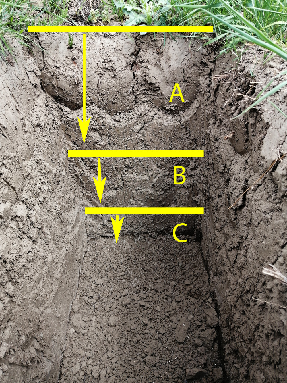
Profile sample:
Alluvium (Fluvisol) or Haplic Fluvisol (calcaric, clayic), carbonated, salted and acidified, deep, clayish, recent.
(A) 0 cm-40 cm
Clayish, low presence of carbonates, brown color, average moisture, fine to very fine granular structure, average amount of humus.
(B) 40 cm-60 cm
Light brown color, sandy-loam with fine granular structure, oxide – reduction processes of Iron and Manganese in form of spots and stains, more carbonated, moderate amount of humus and average moisture.
(C) 60 cm-80 cm (III) Sandy structure, very carbonated, light brown to light yellowish color, oxide – reduction processes of Iron and Manganese in form of spots and stains, low amount of humus, average moisture.
Detailed evaluation
A detailed evaluation determines the appropriate percentage class for each square meter of the land consolidation area and thus creates a precondition for determining the value of each individual parcel. The basis is represented by pedological profiles from the orientation evaluation, but if necessary, and also within the detailed evaluation, by additional field sampling (opening new profiles or taking a sample with a probe).
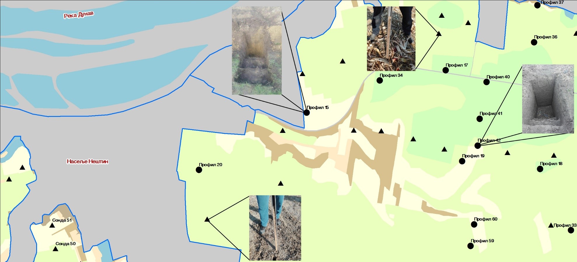
Example of detailed evaluation map
The end product of a detailed assevaluation is a map with precisely defined boundaries of the evaluation classes. MapSoft aerial imaging products are a significant help in definition of the boundaries between classes. High-resolution digital orthophoto is used as a basis for the survey of the area, while digital terrain model gives a clearer picture of the vertical representation of the terrain, both in the preparation of the terrain tour in the orientation evaluation and in defining the characteristic terrain lines in the detailed evaluation.
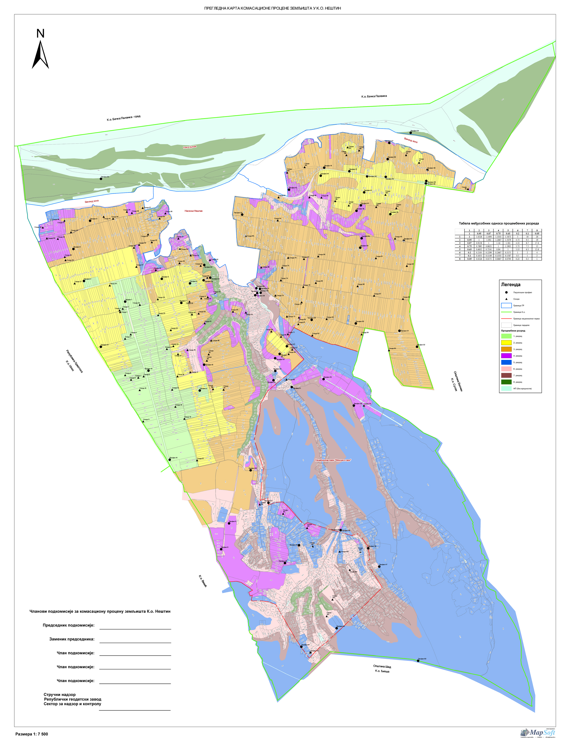
Example of detailed evaluation map
Land classification
Land (cadastral) classification is a procedure that follows the establishment of the geometry of new parcels. The goal of land classification is to assign to each cadastral parcel an adequate cadastral culture, class and purpose of land or object. This procedure is important because the basis for tax calculation is determined on the basis of cultures and classes. Unlike the land evaluation, the data from the classification are an integral part of the real estate cadastre in the new condition, so the significance of the attributes on the plots obtained by classifying the land is thus greater.
As a basis for land classification, agronomy engineers use the existing cadastral status for the cadastral municipality in which the classification is performed, and in rare cases at the cadastral level, with recording the actual situation in the field related to represented cadastral cultures by excavating pedological profiles, similar to land evaluation. The principle and essence of opening pedological profiles in the process of land evaluation and land classification of land is the same, but their ultimate purpose is different. As a rule, pedological profiles in land evaluation and land classification are first opened on the best arable land in the land consolidation area, where lands of similar or the same quality will be classified as lands of the same survey class or the same cadastral class. The basis for opening pedological profiles in land classification is one culture and one class, while in land evaluation, culture is not important, but only the quality of the land.
Having in mind the above, the range of cadastral classes can vary independently of the evaluation, ie. it does not have to start from the 1st class or go in order, but some can be left out, while in the evaluation it is not possible. In the practice of land classification, cadastral classes of land are often abolished, but also crops which are slightly few in the current state in the cadastre, and the reason is the improvement of land quality, more precise way of land classification, but also the absence of cadastral cultures in the field. In the process of land classification, it is necessary to perform physical and chemical analyzes of the soil, by taking soil samples in a disturbed condition. Necessary analyzes, prescribed by the currently valid Rulebook on land classification and land evaluation, include:
- Mechanical composition (texture triangle)
- Hygroscopic soil moisture
- Soil reaction (pH in H2O and n / 10 KCl)
- Soil hydrolytic acidity (“Y1”)
- Sum of adsorbed base catnip (“S”)
- Humus content
- Carbonate content (qualitative and quantitative).
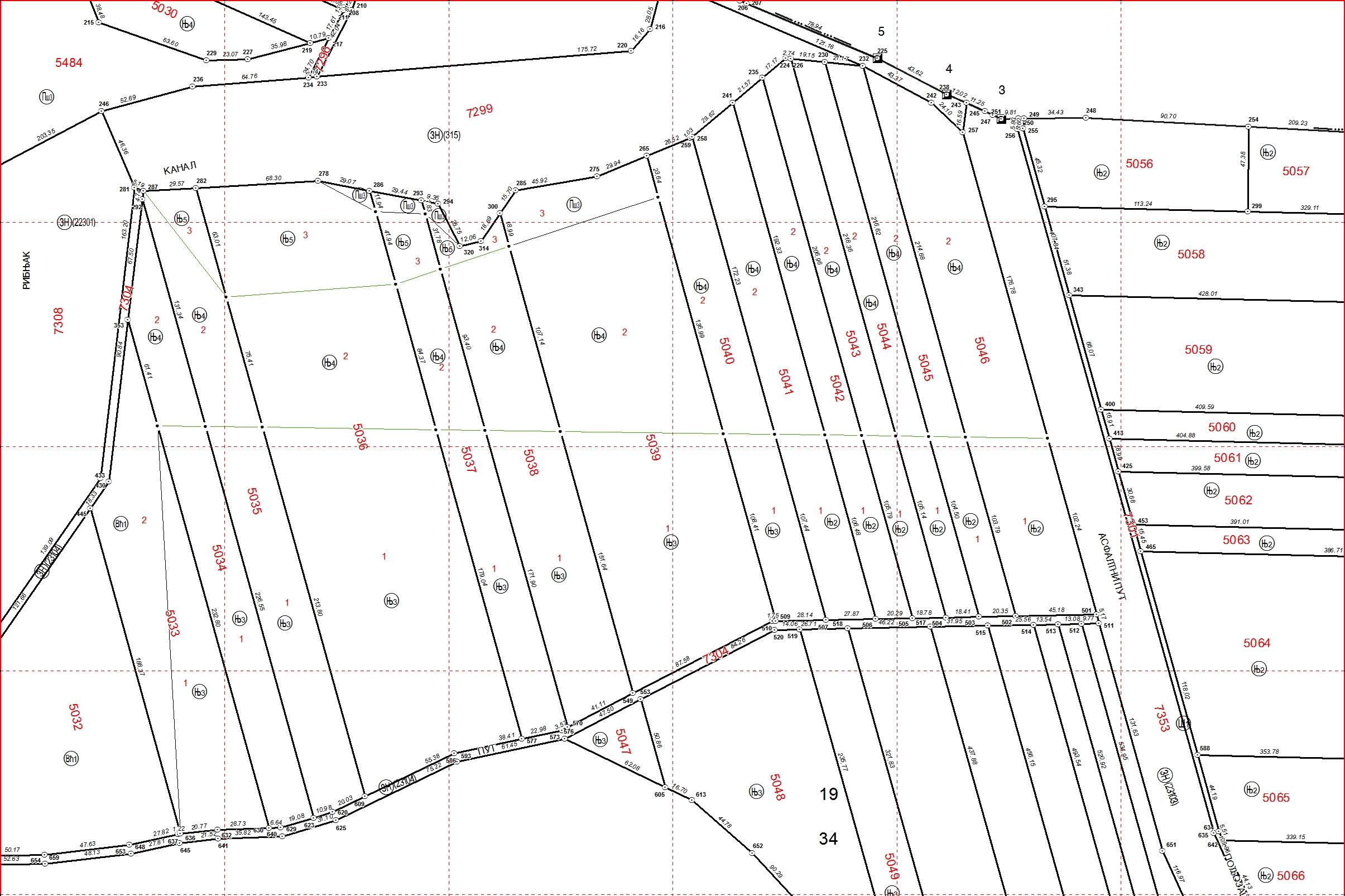
Example of drawing after land classification process