")
")
Cadastral survey in urban area
Cadastral surveys in urban areas are a complex organizational and technical project. These projects are implemented according to strict legal and professional rules. For MapSoft, these projects are challenging because they enable the application of a wide range of modern technology knowledge.
The result of the project is a spatial database with precise geometry, correct topology and all the necessary thematic attributes for parcels (such us owner, land use,…) and buildings (number of floors, house numbers, …).
Methodology
The main survey method is the aerial photogrammetry, although it is complemented by polar surveying (using total stations) and GNSS survey. The result of the project is a spatial database with precisely and topological corected defined parcels, paerts of parcels and buildings boundaries with reqired thematic atributes such us owners, land use, … for parcels and number of floors, house numbers, … for buildings
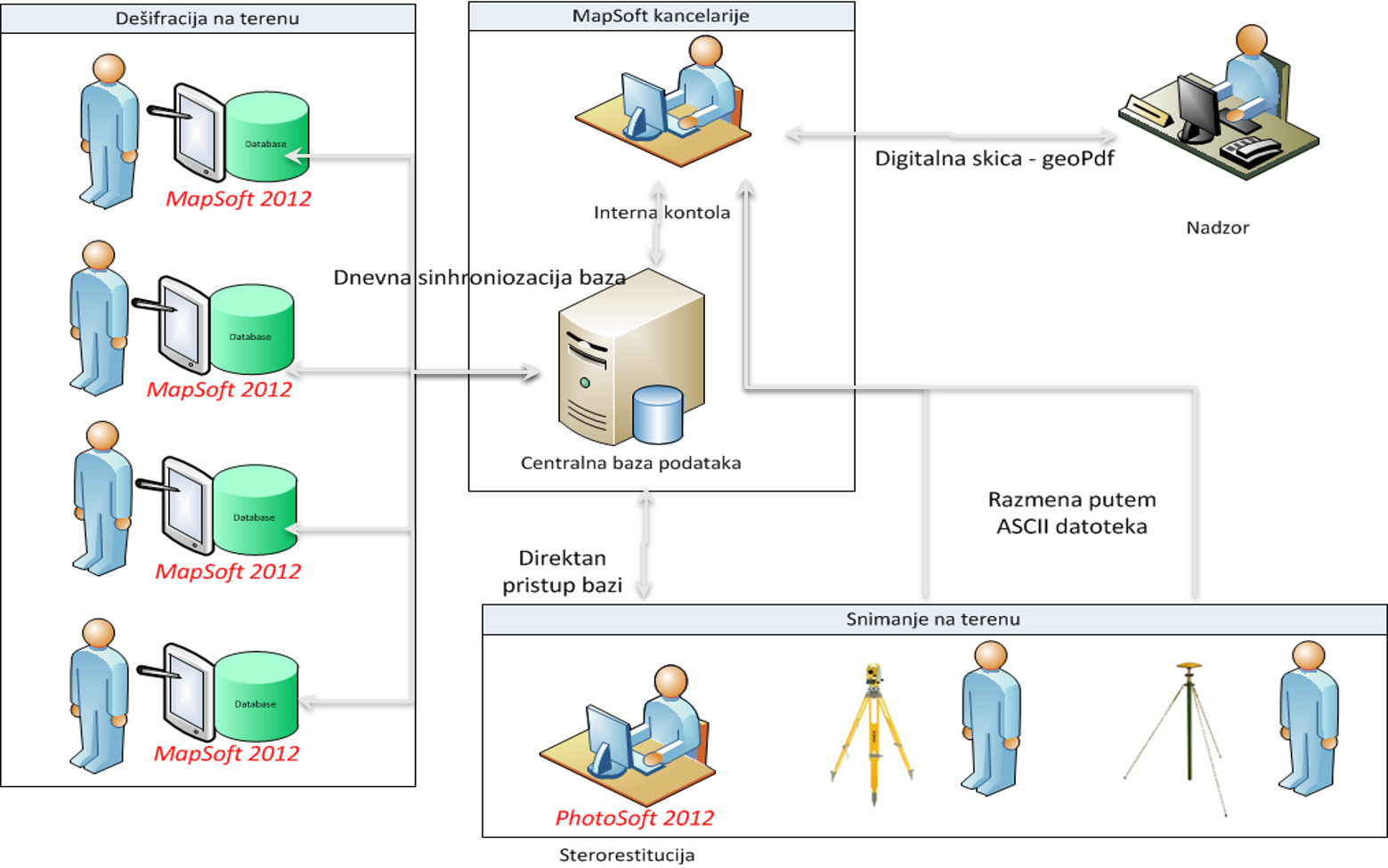
All data is collected digitally, with a centralized system of data collection and project management. As a basic software tool for collecting data digital photogrammetric stereorestitution is used photogrammetric station PhotoSoft, while the input data collected by polar method and GPS is entered in software MapSoft 2012. MapSoft 2012 is also used for field work and control the data collected. For one project, central database is set and all users whether they are working on the field, collecting data through PhotoSoft or MapSoft work directly on the data of that central database.
Implementation phase
Phase 1
PREPARATORY WORKS
Phase 2
AERIAL PHOTOGRAPHY AND DIGITAL ORTHOPHOTO (DOP) PRODUCTION
Aerial photography should be performed according to the flight plan with more flight lines and larger overlap of photographs, instead of performing only one optimal flight, as it used to be done in the standard application of the method. By using the technology of the digital photogrammetry, it is theoretically possible to form stereo pairs from all the photographs that overlap. The biggest reason for more overflights over the project territory is to reduce the amount of occlusions in stereo pairs that arise due to the known limitations of the central projection in urban areas (appearance of occluded areas caused by buildings).
For the georeferencing of a block of aerial images using the procedure of aerial triangulation, it is obligatory to include the points of the surveying/geodetic network as control points.
Phase 3
FIELD IDENTIFICATION
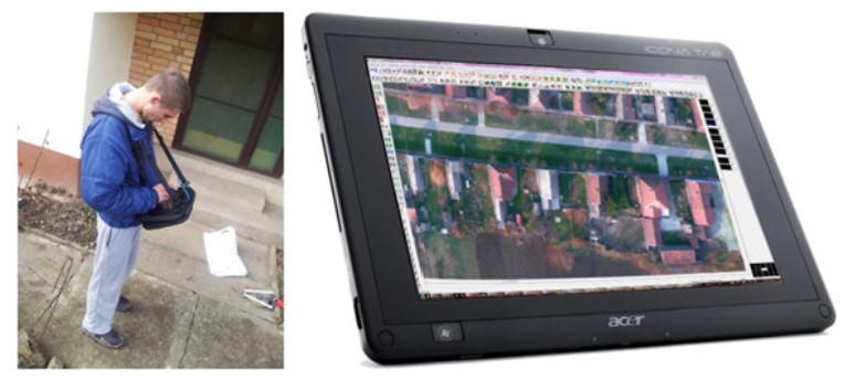
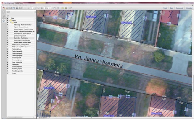
The process of field identification within the classical application of aerial photogrammetry method of survey was done by sketching i.e. drawing the data of the future cadastral map on the magnified digital orthophoto during on-site field identification of spatial features that are the subject of the survey. MapSoft 2012 software for topological and descriptive data acquisition should be used for the drawing-sketching during the field identification.
The aim is to collect all the geometric, thematic and topological attributes for all spatial entities of DCM, including the additional data on the holders of the property rights, during the identification process.
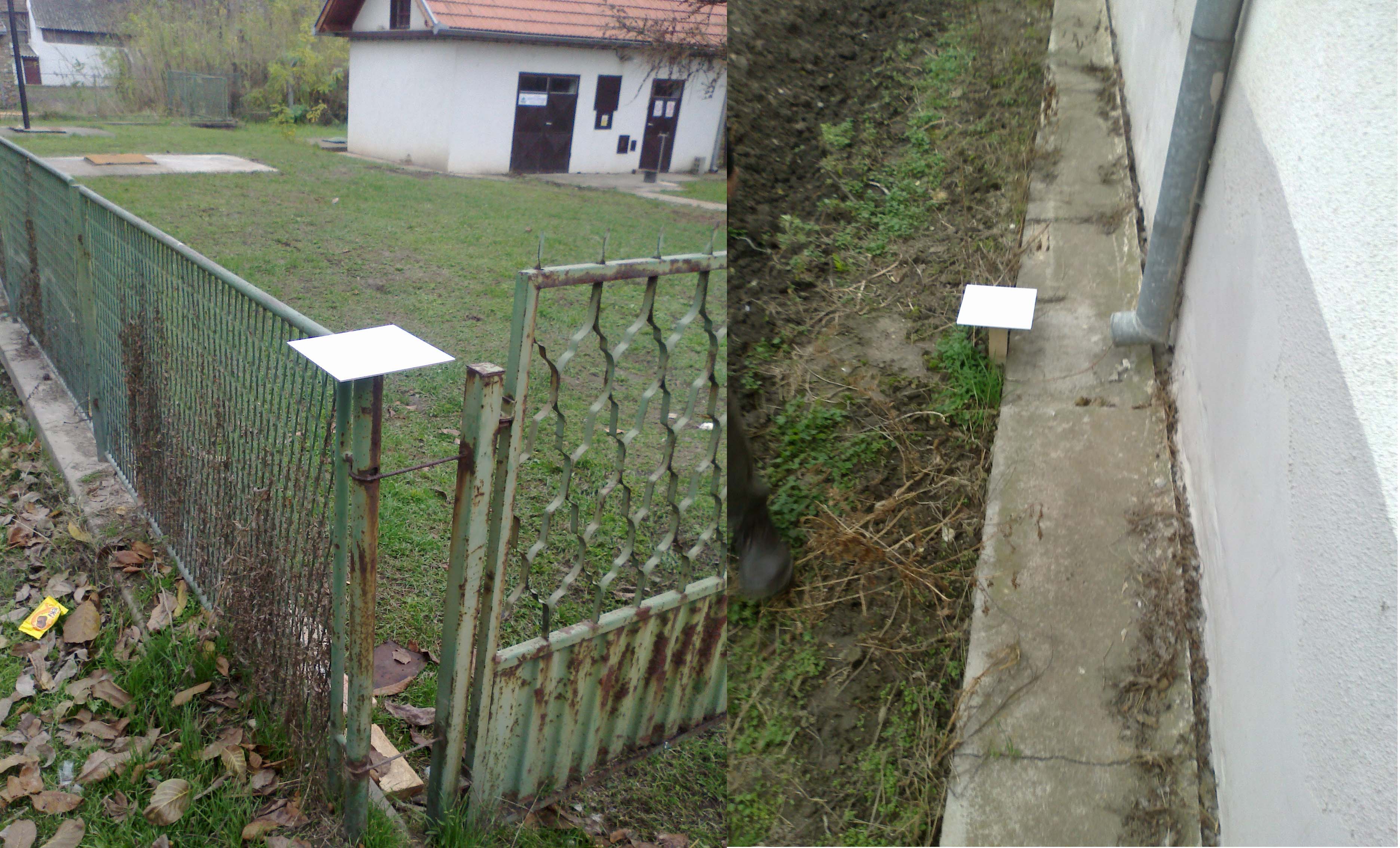
During the field identification process, a surveying professional identifies the marked boundaries of parcels and buildings on the field and digitize (sketches) them using digital orthophoto as background. Statement of the holder of the property rights is also taken into account. The comparison of parcel geometries with their geometries as they were recorded before the survey renovation is also done, in order to timely remove possible discrepancies and inconsistencies.
Phase 4
DETERMINATION OF THE COORDINATES OF BOUNDARY POINTS OF CADASTRAL PARCELS AND BUILDINGS
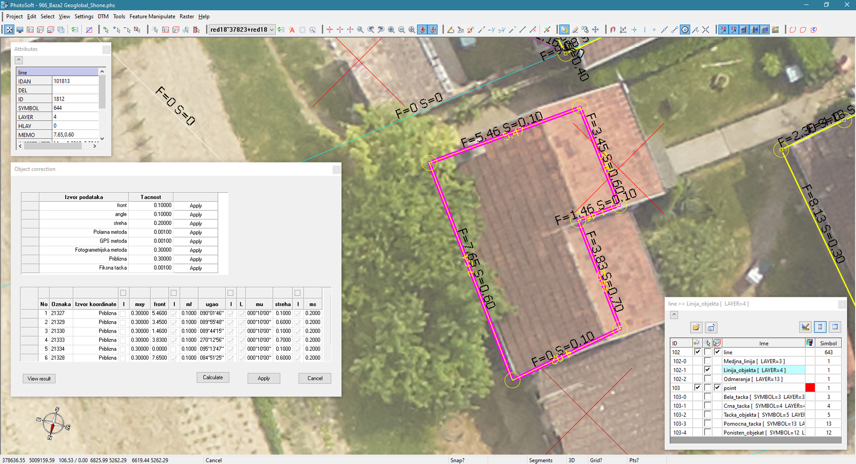
After previous pahse database contains approximate geometry, correct topology and all the necessary thematic attributes for parcels and buildings. The next task is to define the precise coordinates of points that were identified on the field. Thus, for photo signalized points, positioning is as a rule done by using the method of stereo mapping on a digital photogrammetric workstation PhotoSoft. For non-photo signalized points positioning is done by using polar method, if the point is visible from the geodetic/surveying network, or by using GNSS method.
Upon the determination of the exact position of points by using one of the positioning methods, the data is sent into the central database. Having in mind that the model of data with explicit topological connections has been implemented, using the topological connections between different spatial entities such as boundary points, edges and polygons, geometries of dependant boundary polygons and edges of parcels and buildings are automatically adjusted.
Phase 5
CONTROL AND VERIFICATION
Having in mind that database replicas on tablet computers are synchronized with the central database at least once a day, it is possible to monitor the level of realization of field identification on a daily basis, as well as to perform control of the finalized work. The control of geometrical, thematic and topological content of the DCM database is performed using visual data verification and spatial-thematic database queries.
Phase 6
FINAL WORK
The result of the project completion is a unique database containing all collected data and a register of the completion of the cadastral survey through which the procedures and results of the process of project implementation are well documented.
The final database which was established as a result of data acquisition can be divided into two key segments:
• Digital Cadastral Map – spatial part of the database with a corresponding collection of thematic attributes,
• Property data, data on holders of the ownership rights, and the relationships between these two collections of data.
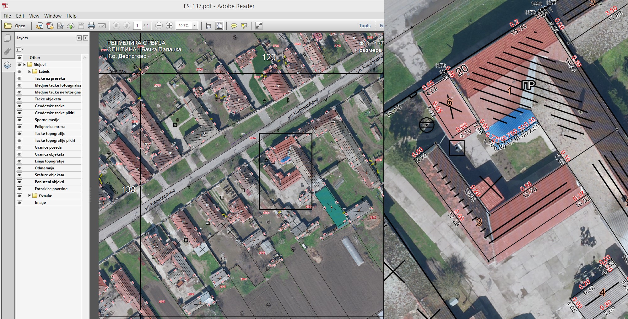
The most important part of the cadastral survey records is with no doubt the set of field photographic sketches. In the proposed methodology, sketches should be treated as one of the ways to visualize the collected geometrical, topological and descriptive data, in a manner that is similar to the utilization of conventional field sketches.
Realized projects
- K.o. Maglić
- K.o. Opovo
- K.o. Nova Gajdobra
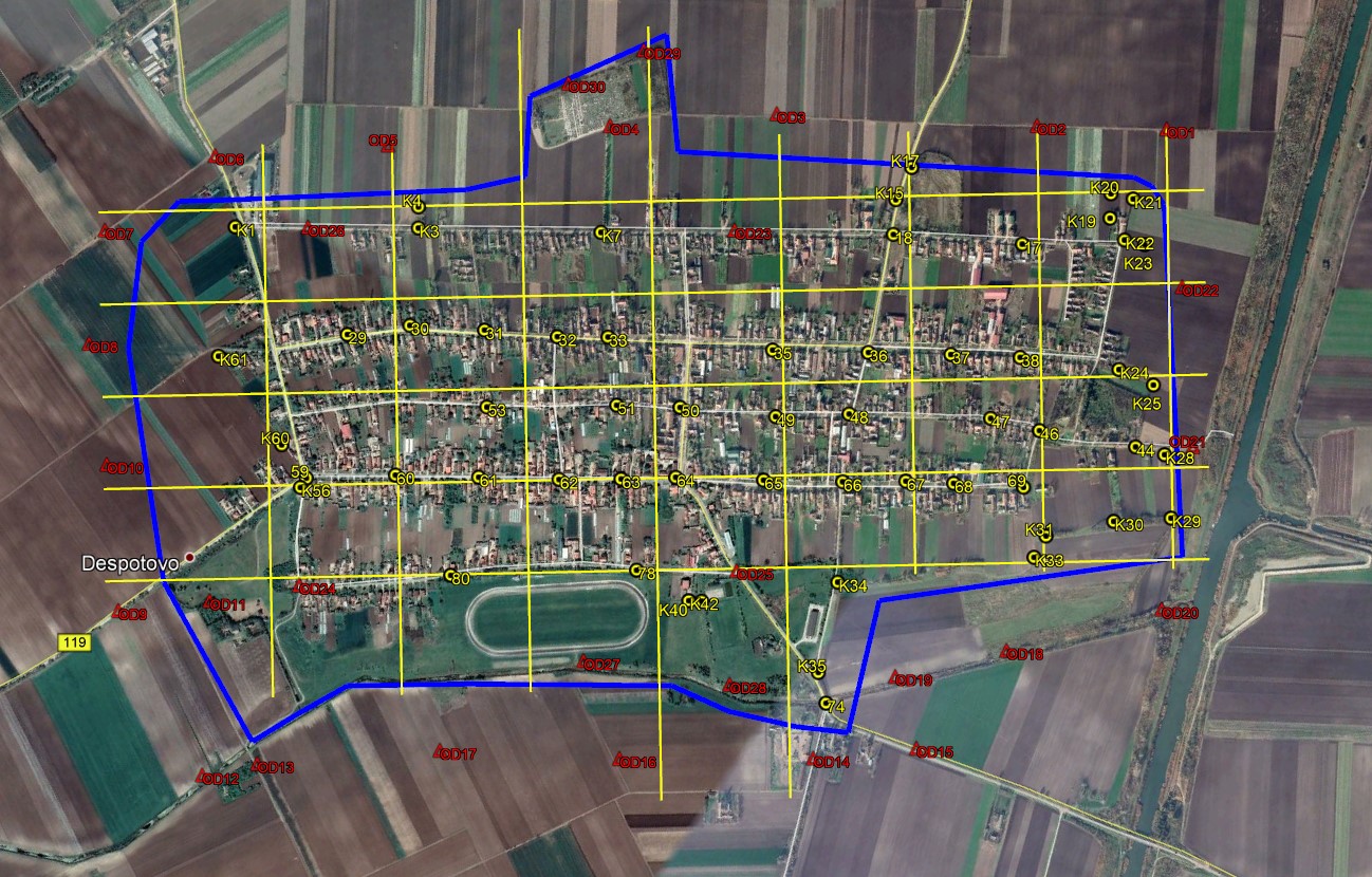
- K.o. Despotovo
- K.o. Kulpin
On going projects
- K.o. Bački Petrovac
- K.o. Neštin
- K.o. Vizić