")
")
Maps
Vectorization
A conversion hardcopy (paper) maps or plans to vector format is an actual problem since hardcopy cartographic products of cadaster, corporate and municipal map archives are falling into disrepair. The digitization (digital map generation) is the only way to save the valuable information. MapSoft has great experience in the realization of projects vectorization for different types of maps.
Vector maps can be delivered as:
- Geospatial database (MS SQL Server, MySQL, SQLLite, …)
- Standard GIS file formats (ESRI shape files, MapInfo mid/mif, GML, …)
- Standard CAD file formats (Autodesk dwg/dxf, Bently Microstation dgn, …)
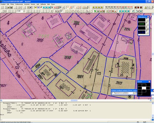
Digitizing of scanned and rectified maps
Digitizing of scanned and rectified maps is performed manually on the screen in MapSoft 2012, semiautomatic or fully automatic. In creation of digital map data model prescribed by client.
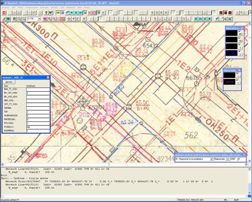
Maps vectorization
One of the most complex vectorization jobs is the vectorization of cadastral maps and the vectorization of utility maps. In both case, vectorization involves the creation of complex data models based on strict topological rules.
Custom map production
MapSoft produce printed, digital and online maps of various territory, scales and size using own spatial data, which is made in the last 18 years, as well as other available sources of information (open source maps, customers data, …).

Printed maps
Regardless of the expansion of digital maps, printed maps still play a significant role. Maps can be made according to your specification and could be printed in various material such us: various types of paper, foil, canvas, plexiglas, tarpaulin, forex … Maps are printed in high resolution on the highest quality printing machines. Printed map dimensions are adapted to your needs
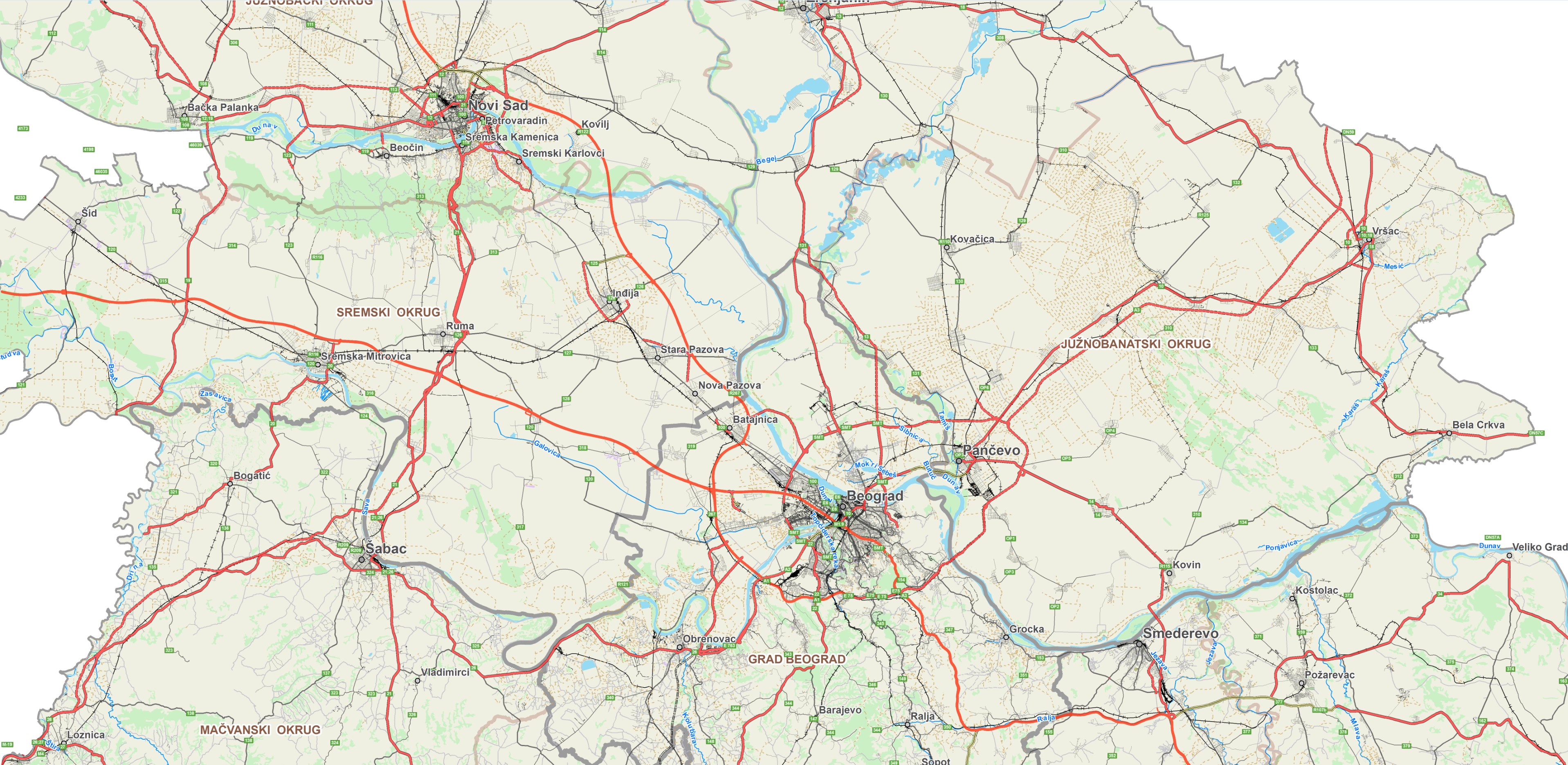
Digital maps
Digital maps production heavily relies upon a vast amount of data collected over time. Most of the information that comprise digital maps is the culmination of satellite imagery, aerial images as well as street level information. MapSoft is able to update maps frequently to provide users with the most accurate reflection of an area of interest. Method of preparation and map format adapts to the client, so the digital maps can be prepared as standard GIS vector formats (geospatial database, file format (GML, KML, ESRI shape files, …)), CAD standard vector formats (dwg, dxf, dgn,…), raster formats (geotif, tiled tif, tiled tif,jpeg 2000, ecw, …) or as a combination of all.
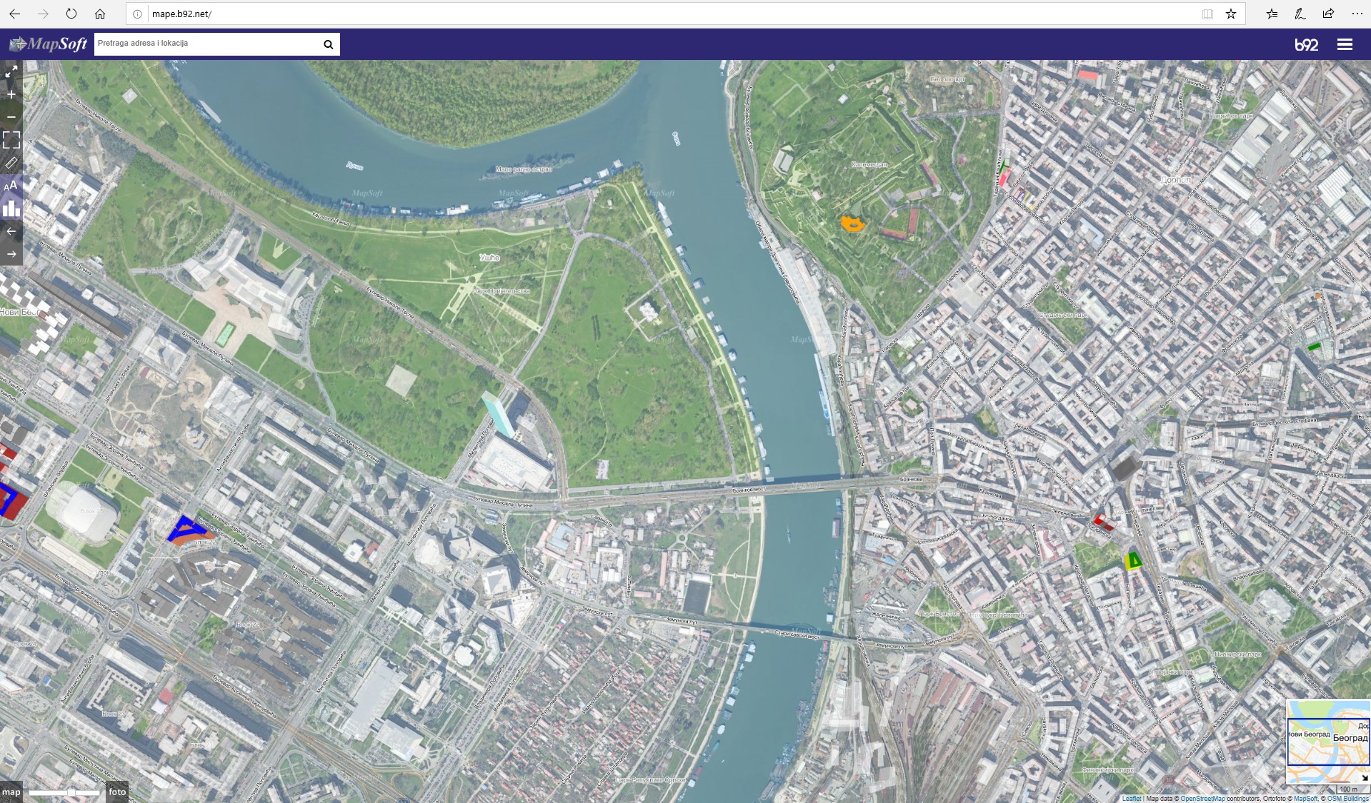
On line maps
Service Maps of Serbia allows users to easily find the location in Serbia using visual navigation and the different types of search. This service promotes the production of digital orthophotos and other geodata which are owned by the company. Service Maps of Serbia was started in 2004. MapSoft has developed new software, improve the quality of service and in cooperation with B92 promote this service. Apart from Belgrade, the project includes 50 more cities in Serbia. Service is located at:
Link